Bridge Walk – Lake Macquarie – Northern Boundary & Ridge Trails
Posted On September 28, 2021
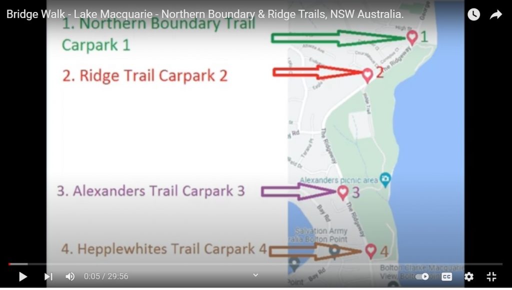
Walk – Lake Macquarie NSW Australia. I call this the “bridge walk”, I don’t believe anyone else does! I call it this because, if you walk along the waterline you go across a number of bridges. Along the way, I discovered other walks in the same area called the Awaba Bay Conservation area. There are 4 different car park areas, on The Ridgeway, which is situated between Bolton Point & Marmong Point, NSW, Australia. At the beginning of the video is a map of the carparks I have also included a pic of it here on this page. (also see google map links below). The 4 different walks are:
1. Nothern Boundary Trail
2. Ridge Trail
3. Alexanders Trail
4. Hepplewhites Trail
The YouTube Video
Image of the 4 walk/trail car parks – see individual map links below
This is an image only and does not link to the video